
The site survey is one of the slowest steps in a residential solar project. A crew drives to the property, sets up a ladder, climbs the roof, and measures each section by hand. They notice vents, chimneys, skylights, and other obstacles, then try to judge how much shade the surrounding trees will cast.
It's also one of the riskiest steps. Falls are the leading cause of death in US construction, according to OSHA, and steep or wet roofs make every climb more dangerous.
The bigger problem is what happens when the data comes back incomplete. A missed measurement, an obstacle nobody noticed, or a shading issue spotted too late means a second visit, a redesign, or a system that doesn't match the proposal. Each of those costs time, money, and customer trust.
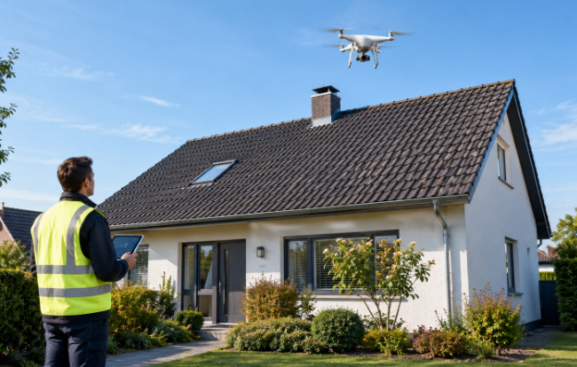
A drone survey replaces the climb with a short automated flight. The process has four steps:
Plan the flight. The pilot opens a flight planning app on a phone or tablet, selects the roof on a map, and sets the flight height and image overlap.
Capture the roof. The drone flies a pre-planned pattern over and around the house, taking dozens of overlapping photos from different angles. A typical home takes minutes, not hours.
Build the model. Drone roof survey software stitches the photos together using photogrammetry, the same technique used in professional mapping, to create a 3D model of the roof.
Measure and analyze. From that model, the software calculates roof pitch, area, and dimensions, marks obstacles, and runs a shade analysis.
The crew stays on the ground the entire time. The result is a complete digital record of the roof that the design team can measure again at any point, without another site visit.
Shade is one of the main reasons a solar system underperforms. A tree that blocks the sun for a few hours each afternoon, a chimney that shadows one corner of the array, or a neighboring building to the south can all cut production well below the estimate in the proposal.
The challenge is that shade changes throughout the day and across the seasons. A roof that looks clear at noon in summer may sit in shadow on a winter afternoon. Judging that from the ground, or from a single visit, is mostly guesswork.
A 3D model solves this. Because the software knows the exact shape of the roof and the objects around it, it can model how shadows move across each roof surface over the year. Designers can then place panels where they'll produce the most energy and avoid the spots that would drag the system down.
Getting shade right before design matters for the customer too. Homeowners judge a system by whether it delivers what was promised. Accurate shade data at the start makes that promise realistic.
The savings from drone surveys come from removing waste across the whole project:
Fewer roof climbs. Less time on ladders means less risk for crews and less time spent per site.
Fewer return visits. A full digital record means the design team rarely needs to send someone back for a missed measurement.
Faster proposals. Measurements and shade data are ready soon after the flight, so quotes can reach homeowners while they're still interested.
More accurate sizing. Precise roof dimensions and shade data reduces the risk of ordering the wrong equipment or redesigning the system after installation starts.
For smaller installers, these gains add up quickly. A crew that spends less time surveying can complete more installations with the same team.
Drone surveys aren't a perfect fit for every job, and installers should know the limits:
Weather. Strong wind, rain, and low light ground the flight or reduce image quality. Surveys still depend on a decent day.
Airspace rules. Properties near airports or in restricted zones may need extra permission to fly, and some areas don't allow drone flights at all.
What's under the surface. A drone sees the roof from above. It can't check rafters, decking or attic conditions. Older roofs, or roofs showing signs of damage, still need an in-person structural inspection.
Pilot requirements. Commercial drone flights require a licensed pilot under local aviation rules, such as Part 107 certification in the US.
The practical approach is to treat drones as the default for measurement and shade analysis, and maintain in-person inspections for roofs that need a closer structural check.
For crews considering drone surveys, the first steps are simple:
Get a pilot certified. Check your local aviation rules and get at least one team member licensed for commercial flights.
Choose the right drone. Most residential surveys don't need expensive equipment. A reliable drone with a good camera and support for automated flight planning is enough to start.
Pick software that fits your workflow. Look for tools that produce the outputs your designers already use: roof measurements, shade analysis, and reports you can share with homeowners.
Start with a few test jobs. Fly roofs you've already measured by hand and compare the results. It's the fastest way to build confidence in the process.
The site survey has long been the step that slows solar projects down. With drones, it can become one of the fastest and one of the safest.
SightFlight is a drone software that turns a single autonomous flight into 3D roof models, measurements, shade analysis, and client-ready reports for solar and roofing teams.