

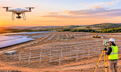
The real split isn't old versus new. Ground crews measure the exact spot their instrument sits on, while a drone measures the whole surface around those spots. Once you see the two methods as measuring different things, the choice stops being a contest.
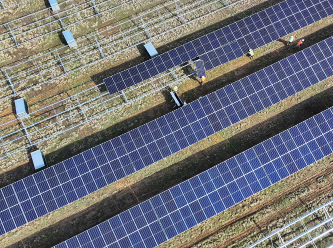
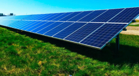
That matters in renewables because the sites are big, open and often remote. A utility-scale solar farm, a wind farm access road or a substation cable route all need a reliable model of the ground long before any steel goes in.
A traditional survey records individual points one at a time with a total station or GNSS rover. A drone survey flies a UAV over the site and records the whole surface in a single pass.
Ground-based methods are precise exactly where the instrument points. Everything between those shots is interpolated, so a drainage dip between two points simply doesn't exist in the model. On a 50-hectare solar site, those gaps decide where water pools and where piling crews hit trouble.
Accuracy depends on the instrument, and published test figures show the spread clearly:
| Instrument | Typical accuracy | Source of figure |
| Total station | Sub-centimeter on the observed point | RTK Data |
| RTK rover | 1 to 2 cm horizontal, 2 to 5 cm vertical | RTK Data |
| DJI P4 RTK, no GCPs | About 3 cm | Terra Drone Europe test, cited by Heliguy |
| DJI M300 RTK, no GCPs | About 3 cm horizontal, 5 cm vertical | Test results cited by Heliguy |
| Drone flown without RTK | Height errors up to 30 cm | Field tests cited by RTK Data |
The bottom row matters most. A drone without RTK correction is a mapping camera, not a survey instrument.
A drone survey is cheaper than a traditional survey on most medium and large sites, because one pilot replaces a multi-day field crew.
A published 100-acre topographic comparison from ROCK Robotic, mapped to 1-foot contours over mixed terrain with moderate tree cover, gives clear field-labor numbers:
| Metric | Traditional survey | Drone LiDAR survey |
| Field time | 5–7 days | 3–4 hours, with about 25 minutes of flight |
| Crew | Two-person crew | One pilot |
| Field labor cost | About $7,200 (2 surveyors, 8 hrs/day, 6 days, $75/hr) | About $300 (4 hours at the same rate) |
| Data density | Sparse under trees | Millions of points, including ground under canopy |
That works out to a cut of over 90% in field time and labor cost. The hidden savings sit outside the table. Every return visit a ground crew avoids is a day not billed, and launching from a roadside instead of walking live corridors removes access permits and service interruptions.
Capital costs run the other way. Total stations and rovers outlast drone airframes, so budget for aircraft replacement in any long-term comparison.
A total station is more accurate at a single point. An RTK drone survey is accurate enough for most topographic and earthworks tasks, typically landing within 2–5 cm with proper control and processing.
The single-shot number rarely decides a renewable project, though. A civil engineer grading a solar array cares whether the whole surface sits correctly against the design. RTK Data shows that a 5 cm vertical bias across 10 hectares shifts about 5,000 m³ of material against a design surface. That's enough to wreck a cut/fill budget.
Vegetation changes the picture. A camera-only drone sees the canopy top, while LiDAR's multiple returns reach the ground through gaps in foliage. The USGS 3DEP program sets a 10 cm RMSEz vertical standard for non-vegetated terrain at Quality Level 1 and 2, a public benchmark for testing any drone dataset.
The safeguard is simple: no drone surface goes out without independent checkpoints. Surveyed ground shots held back from processing keep the result testable.
Drone surveying is much faster than ground surveying. Heliguy's indicative figures put total project time at about 2–3 weeks for a traditional ground survey and 1–4 days for a drone survey.
Speed comes from what the drone skips. Nobody walks the site shot by shot, nobody lays out dozens of ground control points, and a network RTK subscription over NTRIP removes the base station setup. In one Southern Nevada case cited by RTK Data, dropping GCP work saved 2 to 3 hours per mission, and skipping a local base station saved another 30 to 60 minutes.
Capacity scales too. A DJI Matrice 300 RTK with a Zenmuse P1 covers up to 7.5 km² per day, which puts a full wind farm layout or a long transmission corridor within one or two days of flying.
Drone surveys are safer because the pilot collects data from a distance instead of walking steep slopes, live roads or unstable embankments.
Matrix Consulting Engineers points to rail as a clear example. Ground surveys near track need site access, track-closure permits and extra fees, while a drone launches from a safe spot nearby. The same logic applies to wind turbine pads on ridgelines and rooftops on commercial buildings, where scaffolding, harnesses and cherry pickers carry their own risk.
The result is lower field risk, not zero risk. Drones don't replace fall protection, and airspace rules, line-of-sight and weather limits still ground flights.
Drones fit at almost every stage of a renewable project, from site selection through construction to operations.
On greenfield sites, a drone surface model supports layout, drainage design and cut/fill estimates. Software such as DJI Terra calculates volumes once you draw a boundary. On access roads and cable routes, corridor mapping replaces days of instrument setups. Thermal and multispectral sensors add data a ground crew can't collect.
Rooftop solar is where the gap between methods is widest. Measuring a commercial roof by tape and inclinometer means hours at height and a handful of points. A short drone flight captures the full roof geometry, obstructions and surrounding trees in one pass. Platforms like SightFlight turn that flight into shade analysis and PV production reports, so installers price and design a system without sending a crew onto the roof.
A traditional survey remains the right choice for legal boundaries, cadastral work and precise setting-out, where point accuracy and legal acceptance matter more than coverage.
Most projects run a layered workflow, in this order:
Control: the ground crew sets and measures reference points and checkpoints with RTK GNSS. Even an RTK drone job needs at least one GCP to fix the datum.
Tie-ins: the crew connects the job to existing benchmarks, utilities and grid connection points.
Boundary work: legal lines stay with the licensed surveyor and ground instruments.
Surface capture: the drone flies the full site for volumes, design and progress records.
Comparison: the team checks each drone surface against drawings and CAD overlays to flag deviations early.
Teams that skip the first step end up with a sharp, detailed model sitting in the wrong place.
Drone surveys are easy to repeat, so weekly or monthly construction progress monitoring becomes practical in a way ground surveys rarely allow.
Balfour Beatty reported that a stockpile survey that took a surveyor about a day was flown in 15 minutes, with the model processed in about two hours. At that pace, a solar or wind contractor can measure earthworks, track pile installation and verify drainage every week.
Each dataset also becomes a digital twin of the site. The design team re-checks it against revised designs months later without anyone going back into the field. For long-lived renewable assets, that record keeps paying off well after commissioning.